Two things have happened since we returned from Maine.
Dodge Morgan, whom John and I visited on August 15 and who told us of his planned surgery in early September, never recovered from that operation. He died in the hospital on September 14.
I am talking with Dodge's friends and have been asked by Soundings Magazine to write a remembrance of him. That is a privilege, albeit a very sad one. Dodge was one of a handful of individulas I've met over the years that I wanted to get to know better, and never really did. He was a unique human being.
The second event is minor. Bluebird, the Mariner, was launched last Thursday and I got to sail her on Friday. She sailed exquisitely.
Monday, September 20, 2010

It was still dark when we arrived at the entrance to the Cape May Inlet. There was a commercial fishing boat waiting outside the inlet, and we slowed and waited to to see how the seas were breaking on the Inlet. That would give us some idea of how conditions might be if we rounded Cape May Point.
Another fishing boat arrived, and we listened to their radio conversation. The first boat had a steering problem, and the skipper asked the captain of the second boat for some advice.
Meanwhile, dawn was breaking and I was edging Robin slowly toward the point.
There appeared to be a couple of safe routes between the Inlet and the point. The one closer to shore seemed quite narrow when viewed on the chartplotter, and quite shallow. So I chose the one that started a bit farther from the beach and zig-zagged in toward the point.
There was no sunrise on this morning, the sky overcast as we edged closer to the surf line. At about 6:30, we were travelling parallel to the sand in about 15 feet of water, with no problems, when we reached the outer end of the point. If there had been bathers on the beach, we would have needed a bullhorn to talk with them, because it was a few hundred feet away.
I punched in a waypoint well up the Delaware Bay and we turned Robin toward that goal, some wind coming now from the south, and we motorsailed north.
I decided that I'd never go through the Cape May Canal again if the seas were calm. The experience had been bland and without problems.
We motor-sailed up the bay, running with the current until we were past Ship John Light.
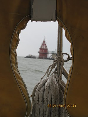
A catamaran that had apparently come through the canal slanted toward us from starboard, slipped across our transom and finally edged ahead of us when we neared the Salem Nuclear plant. The boat entered the Chesapeake and Delaware Canal just ahead of us and it was tied to the town dock in Chesapeake City when we arrived. For the first time in our collected experience, John and I were able to moor at that dock behind the catamaran.
The crummy weather that had threatened us all day coming up the bay cleared to the north, and Engineers' Cove was lit at dinner time with billowing cumulus catching the late afternoon sunlight.
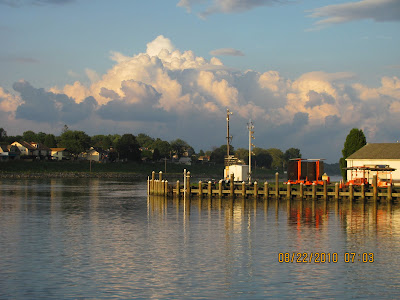
We showered, dined, and after a good night's sleep, we motored and sailed down the Chesapeake Bay to Robin's slip in Cambridge on the Choptank River, arriving in daylight, restored from a fine nine days on board.
Another fishing boat arrived, and we listened to their radio conversation. The first boat had a steering problem, and the skipper asked the captain of the second boat for some advice.
Meanwhile, dawn was breaking and I was edging Robin slowly toward the point.
There appeared to be a couple of safe routes between the Inlet and the point. The one closer to shore seemed quite narrow when viewed on the chartplotter, and quite shallow. So I chose the one that started a bit farther from the beach and zig-zagged in toward the point.
There was no sunrise on this morning, the sky overcast as we edged closer to the surf line. At about 6:30, we were travelling parallel to the sand in about 15 feet of water, with no problems, when we reached the outer end of the point. If there had been bathers on the beach, we would have needed a bullhorn to talk with them, because it was a few hundred feet away.
I punched in a waypoint well up the Delaware Bay and we turned Robin toward that goal, some wind coming now from the south, and we motorsailed north.
I decided that I'd never go through the Cape May Canal again if the seas were calm. The experience had been bland and without problems.
We motor-sailed up the bay, running with the current until we were past Ship John Light.

A catamaran that had apparently come through the canal slanted toward us from starboard, slipped across our transom and finally edged ahead of us when we neared the Salem Nuclear plant. The boat entered the Chesapeake and Delaware Canal just ahead of us and it was tied to the town dock in Chesapeake City when we arrived. For the first time in our collected experience, John and I were able to moor at that dock behind the catamaran.
The crummy weather that had threatened us all day coming up the bay cleared to the north, and Engineers' Cove was lit at dinner time with billowing cumulus catching the late afternoon sunlight.

We showered, dined, and after a good night's sleep, we motored and sailed down the Chesapeake Bay to Robin's slip in Cambridge on the Choptank River, arriving in daylight, restored from a fine nine days on board.
Friday, September 17, 2010
Robin left Newport Harbor just behind Puma, the Volvo Ocean Race 70-footer. By the time her crew had her mainsail up, we were just beginning to raise Robin's.
But there was little wind, and what wind there was was on our nose. So we began motoring on a southwesterly slant out of Narraganset Bay, aiming toward Point Judith and the western side of Block Island ten miles beyond.
We had delayed our departure until 11 o'clock because we knew the favorable wind were not forecast to arrive until later in the day. If they did not arrive, we could always bail out and head down Long Island Sound, to the west.
Some place past Block Island and, to the west, Montauk Point, Robin's mainsail did begin to flutter, and soon, we were enjoying a westerly breeze.
The wind built and came around to the northwest, and we began sailing without the engine.
Then the wind veered to the north, as predicted, and we were on a broad reach. As the wind speed built, so did the weather helm -- the tendancy of the boat to steer up into the wind.
In fact, the weather helm became so strong -- despite our trimming of the sails to counter the effect -- that we were no longer able to steer the boat with the autopilot.
Being thoroughly modern sailors -- which translates into "too lazy to steer the dang boat ourselves" -- we doused the sails and returned to motoring. It was, by now, well into the dark of night.
I was on watch in the early morning hours as we crossed the shipping lanes from Europe to New York. I saw several ships before the one that, on the radar, seemed to be heading our way.
I saw it first at ten miles. Then I saw it (on the radar screen) at six miles. It was about two miles west of another ship, but I physically saw that ship and saw that it was not headed for us.
(You tell the direciton that a ship is traveling by two white lights on masts. The shorter mast is on the front of the ship, the taller one at the rear. If the shorter one is to the left, the ship is traveling from right to left. If the two lights are one directly above the other, it is headed for you.)
When the second ship was two miles away, its lights were one over the other. I radioed our position and asked the ship what it wanted us to do. The master called back and said he saw us and was turning to go to our rear.
The next photo is of that ship, whose lights can be seen if you really strain.
You can see the first light of day seeping into the picture to the right, which, of course, was the east.
It was some time later in the morning that we first began to discuss in honest terms my desire to sail outside of Cape May. I'd heard a couple of professional captains tell of doing this -- of ducking inside the shoals that sit offshore of Cape May Point and taking a narrow channel that leads very close to the beach. One captain told of talking to the bathers on the beach as he passed.
The alternative is going through the Cape May Inlet into Cape May Harbor, then running the four or five miles of the Cape May Canal with its shoal banks to get out to the Delaware Bay.
I thought that if we could take the outside route, we'd save ourselves the stress that the inlet, harbor and canal involve.
John wasn't too sure of my sanity.
"It's your boat," he said, suggesting that if I wrecked my boat, he would be happy to swim ashore.
So John got out the Eldridge tide charts in an effort, I think, to dissuade me.
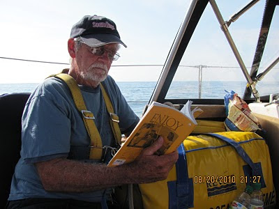
Later, when John was taking another nap and I was on watch, Robin hooked a bluefish. I discovered this fact when I looked aft and saw a gaping jaw dragging behind us. When I began to reel, the fish fought. But it must have been on the line for a while, because its strength was low.
I finally hauled the 31-incher aboard, thanked it for its meat (acknowldging that we, too, would be meat for some species in time) and then butchered it on deck. I took the picture to prove to John the nature of the meat that I would serve him that night.

But there was little wind, and what wind there was was on our nose. So we began motoring on a southwesterly slant out of Narraganset Bay, aiming toward Point Judith and the western side of Block Island ten miles beyond.
We had delayed our departure until 11 o'clock because we knew the favorable wind were not forecast to arrive until later in the day. If they did not arrive, we could always bail out and head down Long Island Sound, to the west.
Some place past Block Island and, to the west, Montauk Point, Robin's mainsail did begin to flutter, and soon, we were enjoying a westerly breeze.
The wind built and came around to the northwest, and we began sailing without the engine.
Then the wind veered to the north, as predicted, and we were on a broad reach. As the wind speed built, so did the weather helm -- the tendancy of the boat to steer up into the wind.
In fact, the weather helm became so strong -- despite our trimming of the sails to counter the effect -- that we were no longer able to steer the boat with the autopilot.
Being thoroughly modern sailors -- which translates into "too lazy to steer the dang boat ourselves" -- we doused the sails and returned to motoring. It was, by now, well into the dark of night.
I was on watch in the early morning hours as we crossed the shipping lanes from Europe to New York. I saw several ships before the one that, on the radar, seemed to be heading our way.
I saw it first at ten miles. Then I saw it (on the radar screen) at six miles. It was about two miles west of another ship, but I physically saw that ship and saw that it was not headed for us.
(You tell the direciton that a ship is traveling by two white lights on masts. The shorter mast is on the front of the ship, the taller one at the rear. If the shorter one is to the left, the ship is traveling from right to left. If the two lights are one directly above the other, it is headed for you.)
When the second ship was two miles away, its lights were one over the other. I radioed our position and asked the ship what it wanted us to do. The master called back and said he saw us and was turning to go to our rear.
The next photo is of that ship, whose lights can be seen if you really strain.

You can see the first light of day seeping into the picture to the right, which, of course, was the east.
It was some time later in the morning that we first began to discuss in honest terms my desire to sail outside of Cape May. I'd heard a couple of professional captains tell of doing this -- of ducking inside the shoals that sit offshore of Cape May Point and taking a narrow channel that leads very close to the beach. One captain told of talking to the bathers on the beach as he passed.
The alternative is going through the Cape May Inlet into Cape May Harbor, then running the four or five miles of the Cape May Canal with its shoal banks to get out to the Delaware Bay.
I thought that if we could take the outside route, we'd save ourselves the stress that the inlet, harbor and canal involve.
John wasn't too sure of my sanity.
"It's your boat," he said, suggesting that if I wrecked my boat, he would be happy to swim ashore.
So John got out the Eldridge tide charts in an effort, I think, to dissuade me.

Later, when John was taking another nap and I was on watch, Robin hooked a bluefish. I discovered this fact when I looked aft and saw a gaping jaw dragging behind us. When I began to reel, the fish fought. But it must have been on the line for a while, because its strength was low.
I finally hauled the 31-incher aboard, thanked it for its meat (acknowldging that we, too, would be meat for some species in time) and then butchered it on deck. I took the picture to prove to John the nature of the meat that I would serve him that night.

We sailed along the Rhode Island Coast to the mouth of Narraganset Bay and then sailed part way in toward Newport before turning on the engine and furling the sails. Opting not to contend with the difficulties of anchoring in a crowded harbor, we called ahead and were assigned a mooring by the Oldport Launch service.
It was about five o'clock when we called the launch for a ride into town. We had our shower bags packed with toiletries and a change of clothes, and we anticipated warm showers at The Seamen's Church Institute, a favorite stop near the waterfront.
But the church was closed except for the nightly AA meeting, so I devised Plan B.
We walked a quarter mile around the harbor to Long Wharf and the Newport Yacht Club, which hosts the Bermuda 1-2 race. I've taken several showers there before and after the race, and I guessed that we might talk our way into two more.
It did take some talking, but we got clean and clothed and then I phoned Capt. Mr. Louie Lagace, my friend who owns a commercial clam boat. He and I had talked about getting together for dinner when we were in town.
Louie met us at Yesterdays Restaurant, where we enjoyed a good meal and some fine conversation.

John, left, and Louie bonded as old sailors will. Then John and I caught a launch back to Robin. The forecast was still good for a departure at noon tomorrow and a straight sail toward Cape May.
Thursday, September 16, 2010
Provincetown, even at five in the morning, shed enough light to make slipping our mooring easy. Quietly, we motored out of the harbor and headed for the entrance to the Cape Cod Canal, twenty-one miles to the southwest.
The air was still and the temperature a bit less chilly than we had experienced farther north. When we were half way across Cape Cod Bay, the sky began to brighten with the new day.

The water was flat calm. Only our wake disturbed the reflected image of the sky above.
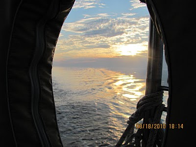
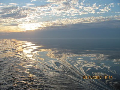
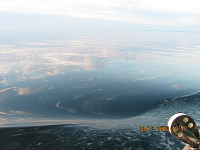
We were on time arriving at the fuel dock in Sandwich and were heading south on the canal at 8:30 a.m. At one point, Robin hit 9.9 knots, not quite as fast as on the way north.
Out on Buzzards Bay, there still was no wind. Motoring was better than battering against seas kicked up by a Buzzards Bay southwesterly.
By early afternoon, we had turned the corner south of Cutty Hunk, and now the wind had arrived -- eight to ten knots on the port bow. We began sailing.
It was about now that Captain John struck a commanding pose.

The air was still and the temperature a bit less chilly than we had experienced farther north. When we were half way across Cape Cod Bay, the sky began to brighten with the new day.

The water was flat calm. Only our wake disturbed the reflected image of the sky above.


We were on time arriving at the fuel dock in Sandwich and were heading south on the canal at 8:30 a.m. At one point, Robin hit 9.9 knots, not quite as fast as on the way north.
Out on Buzzards Bay, there still was no wind. Motoring was better than battering against seas kicked up by a Buzzards Bay southwesterly.
By early afternoon, we had turned the corner south of Cutty Hunk, and now the wind had arrived -- eight to ten knots on the port bow. We began sailing.
It was about now that Captain John struck a commanding pose.

Tuesday, September 14, 2010

The decision where to go next was complicated by the timing of the current change in the Cape Cod Canal. We could make it to several ports along the way during daylight. But none of the ones we considered was very close to the canal entrance.
The distance from York Harbor to Scituate, MA, was not bad. But we would still have 40 miles to go to make it to the canal. The fact that the current turned in our favor at 6:30 in the morning meant we'd have to leave Scituate at about 2 o'clock in the morning.
Plymouth, MA, is about 20 miles closer to the canal. But to get into the Plymouth harbor requires an hour-long detour in some pretty swift currents passing through treacherous shoals.
Then we thought about Provincetown, MA, on the tip of Cape Cod, about 20 miles from the canal. We would arrive there after dark. I'd sailed from Provincetown once before with Tom Gilmore, but my recollection of the layout was hazy.
So we studied the charts and, as best we could see, entering the well-protected harbor posed no serious problems, even after dark. I phoned the owner of the mooring field in Provincetown and learned that we could arrive any time and would be met by a launch, directing us to a mooring.
This became the plan, and we aimed Robin's bow for Race Point.
It was a long day of motoring. We passed outside Isle of Shoals off of Portsmouth, NH, and then steamed at a leisurely pace, seeing the shoreline fade away in the western distance before returning toward us at Cape Ann and Gloucester, MA. We saw the Boston skyline in the hazy distance as we crossed Stellwagen Bank, an area known for whale sightings.
We saw no whales nor much else of interest, but before dark we could see the hazy shape of the Provincetown lighthouse. And then we saw the sun setting, molten, across Massachusetts Bay.
It was ten o'clock in the evening when we rounded the last buoy outside of Provincetown Harbor. With the help of the chartplotter, we lined up the correct red lights and called in for the mooring launch.
Before 10:30, we were on a mooring and bunked down for a five o'clock departure.
During the day, we had received a promising weather forecast for the next few days. It appeared that in two days, the wind would turn around to the northwest and then the east. If that forecast held, we would be able to sail straight from Newport or Block Island to Cape May, NJ. Taking the offshore route, we could avoid an extra day on Long Island Sound, as well as the traffic that that route -- going down the East River by Manhattan -- would include.
We crossed our fingers and hoped.
Monday, September 13, 2010


It was raining at five o'clock in the morning when I awoke. Rain was tapping on the cabintop, and there was fog when I finally looked outside -- fog so thick you couldn't see land in any direction.
I wasn't sure if we'd be sailing this day. I wanted the trip to be easy, not stressful, and wouldn't think of heading out in bad weather.
But by seven o'clock, the fog had lifted a bit and the rain had stopped and within an hour, we were under way.
Lobster boats were heading out with us. Some times you knew because you saw them. Other times, you only heard their diesel engines. The radar was on and we limited our speed, both because of the poor visiblity and also so we could hear other boats.
But by the time we reached the mouth of Quahog Bay, we had enough visibility to see a few hundred feet, so we could motor with some speed.
Quahog Bay is on the eastern end of Casco Bay, which is a serrated coastline of narrow peninsulas and ragged islands that extends east northeast of Portland, Maine, the biggest port on the Maine coast.
We set our first waypoint so as to evade a congestion of buoys that mark the outer reaches of the Portland harbor. And we set the radar for about three miles, since the foge came and went with varying degrees of severity.
Our destination was York Harbor, where I hoped we would arrive in time to have dinner with old (and I mean old ) college friends. If we could arrive in York Harbor by late afternoon, we'd be in time for the meal.
Due to the thickness of the fog off of Portland, we were making constant checks with the radar as well as standing steady watch -- John to port and I to starboard.
I came up from checking the radar screen above the chart table and, ducking out from under the dodger and letting my gaze sweep forward, I was stunned.
There, off the port bow, was a huge yellow steel crane above the fog bank!
I immediately turned Robin to starboard, to John's surprise, I think.
The ship was anchored, making no sound, and it had not appeared on the radar screen, at least in a form I recognized. But as we passed, the fog lifted enough near its stern that we could see its massive shape and know we had nearly rammed its side.
I sey "nearly" although perhaps we had several hundred feet between it and was when we saw it. I still don't know.
In time, the fog cleared and we were able to see Nubble lighthouse on Cape Neddick in York (see photo) and to motor into York Harbor with no problem.
The dinner that night was fun. I was happy that John got to meet my friends. (In the photo, from left, John, Guy Hollingworth, Ann Hollingworth, Nina Hollingworth -- Guy's mom -- Kathy Flagler -- hidden -- Barbara Michael, Curt Michael and Charlie Flagler.)
Subscribe to:
Posts (Atom)
